
Naval War College Review
Volume 65, Number 1 (2012) Winter
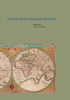
Orbis terrae compendiosa descriptio,a double-hemisphere projection first published in 1569 by the famous Flemish cartographer Gerhardus Mercator 1512–94, famous for the eponymous global projection widely used today for, especially, nautical charts. This version was engraved by his son Rumold (1545–99) and issued in 1587.
The map is one thirty rare maps of similarly high technical and aesthetic value exhibited in “Envisioning the World: The Earliest Printed Maps, 1472 to 1700.” The exhibit, organized by the Sonoma County Museum in Santa Rosa, California, is drawn from the collection of Henry and Holly Wendt. It is now on display at the Naval War College Museum, where it can be seen until 30 November 2011. For further information, visit the Envision the World website.
Full Issue
Winter 2013 Full Issue
The U.S. Naval War College
From the Editors
From the Editors
Pelham G. Boyer
President's Forum
President’s Forum
John N. Christenson
Articles
Beijing’s “Starter Carrier” and Future Steps
Andrew S. Erickson, Abraham M. Denmark, and Gabriel Collins
Seeking Balance
Swee Lean Collin Koh
Review Essays: Fair Warning
Martin Murphy
Book Reviews
Book Reviews
The U.S. Naval War College
International Intervention in Local Conflicts: Crisis Management andConflict Resolution since the Cold War
Larissa Forster
Just War on Terror? A Christian and Muslim Response
Timothy J. Demy
In My Time: A Personal and Political Memoir
Stephen F. Knott
How the Helicopter Changed Modern Warfare
K.J. Delamer
Battle of Surigao Strait
Richard Norton
Reflections on Reading
Reflections on Reading
John E. Jackson
Additional Writings
Commentary
Cathal O'Connor
Review Essays: The Tip of the Iceberg
Norman Friedman
Of Special Interest
The U.S. Naval War College